Challenge: Develop 20-Year Risk-Based Asset Management Plans
The City of Vernon manages a diverse portfolio of infrastructure assets. The City has been using Excel spreadsheets to model and plan for infrastructure renewal. Managing and maintaining numerous spreadsheets proved to be problematic and hindered the City’s efforts to develop more advanced risk-based optimization models to optimize project selections and investment strategies, and meet organizational objectives and performance metrics. The City also needed to implement advanced asset management processes across all asset types using a consistent and generic methodology and a single integrated solution. The desired solution was also required to support cross-asset analysis and be seamlessly integrated with ArcGIS.

“What the City of Vernon wanted was a tool that could take the results of complex spreadsheet-based asset management plans and plug them into modeling tools that could help the City make better risk-based decisions and to help illustrate the consequences of certain funding scenarios, treatment interventions, and levels of service. What appeals to me about IDS software from a technical aspect is that the functionality is tailored to apply against a wide range of asset classes (from airports to pipes to park assets). It also offers the flexibility to either utilize the results of consultant-led asset management plans or to build similar logic within the software. I’ve been very impressed with the level of service IDS has provided and am looking forward to working with them further.”
– Geoff Mulligan, City of Vernon
Solution: Asset Optimizer
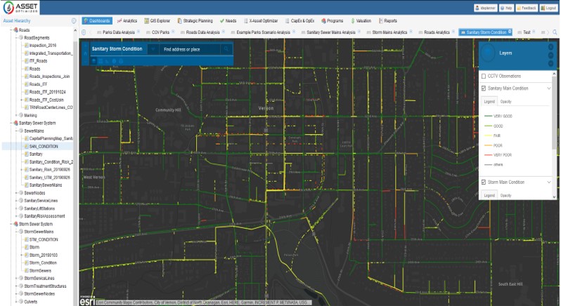
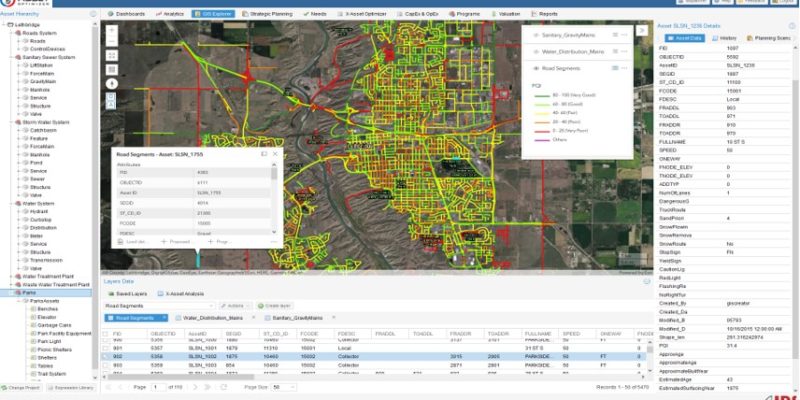
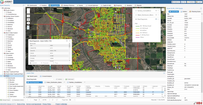
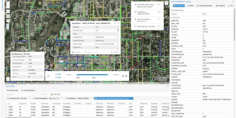
IDS Asset OptimizerTM GIS-centered cloud-based software was used to support lifecycle modeling and asset management planning of the City’s parks and sanitary, stormwater, and roads networks. Assets data were directly imported from ArcGIS feature services and Excel. Asset OptimizerTM was then used to perform in-depth data analysis and develop data-driven deterioration and risk models for different asset classes. Costs and benefits models for various asset intervention actions (e.g., repair, rehabilitation, preservation, and replacement) were developed. Multiple budget and performance target scenarios were defined and used to generate optimal annual project lists that maximize assets performance, minimize the risk, and minimize lifecycle costs. Scenario analysis helped to quantify relationships between funding levels and assets condition and risk metrics, and to develop optimized and defensible 20-year asset management plans. Cross-asset analysis helped identify possible coordination of projects across different asset classes (roads, sanitary and storm sewers) as well as to align these projects with the water program developed by the Regional District of North Okanagan. Integration with ArcGIS enabled the City to leverage ArcGIS web tools such as Story maps and Operations Dashboards. The City is planning to use Asset OptimizerTM to develop capital plans for more asset classes including wastewater treatment plant, airport, and facilities.